


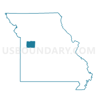
Jefferson Voting District, Johnson County, Missouri
About
Outline

Summary
| Unique Area Identifier | 608886 |
| Name | Jefferson Voting District |
| County | Johnson County |
| State | Missouri |
| Area (square miles) | 59.93 |
| Land Area (square miles) | 59.55 |
| Water Area (square miles) | 0.38 |
| % of Land Area | 99.36 |
| % of Water Area | 0.64 |
| Latitude of the Internal Point | 38.62443860 |
| Longtitude of the Internal Point | -93.57819840 |
Maps


Graphs
Select a template below for downloading or customizing gragh for Jefferson Voting District, Johnson County, Missouri


Neighbors
Neighoring Voting District (by Name) Neighboring Voting District on the Map
- Green Ridge/Elk Fork/Washington Voting District, Pettis County, MO
- Knob Noster Voting District, Johnson County, MO
- Montserrat Voting District, Johnson County, MO
- Post Oak Voting District, Johnson County, MO
- Springfield / Tebo Voting District, Henry County, MO
- Windsor Ward III, Henry County, MO
Top 10 Neighboring County Subdivision (by Population) Neighboring County Subdivision on the Map
- Washington township, Johnson County, MO (7,249)
- Windsor township, Henry County, MO (3,473)
- Post Oak township, Johnson County, MO (2,022)
- Montserrat township, Johnson County, MO (1,861)
- Green Ridge township, Pettis County, MO (1,080)
- Tebo township, Henry County, MO (844)
- Jefferson township, Johnson County, MO (737)
- Elk Fork township, Pettis County, MO (419)
Top 10 Neighboring Unified School District (by Population) Neighboring Unified School District on the Map
- Warrensburg R-VI School District, MO (25,863)
- Knob Noster R-VIII School District, MO (8,419)
- Henry County R-I School District, MO (4,607)
- Green Ridge R-VIII School District, MO (2,124)
- Leeton R-X School District, MO (1,883)
Top 10 Neighboring State Legislative District Lower Chamber (by Population) Neighboring State Legislative District Lower Chamber on the Map
- State House District 116, MO (38,212)
- State House District 121, MO (37,199)
- State House District 118, MO (36,454)
- State House District 120, MO (35,276)
Top 10 Neighboring State Legislative District Upper Chamber (by Population) Neighboring State Legislative District Upper Chamber on the Map
Top 10 Neighboring 111th Congressional District (by Population) Neighboring 111th Congressional District on the Map
Top 10 Neighboring Census Tract (by Population) Neighboring Census Tract on the Map
- Census Tract 9603, Johnson County, MO (8,910)
- Census Tract 9607, Johnson County, MO (5,908)
- Census Tract 4802, Pettis County, MO (5,867)
- Census Tract 9609, Johnson County, MO (4,939)
- Census Tract 4803, Pettis County, MO (4,256)
- Census Tract 9502, Henry County, MO (3,809)
- Census Tract 9501, Henry County, MO (2,977)